


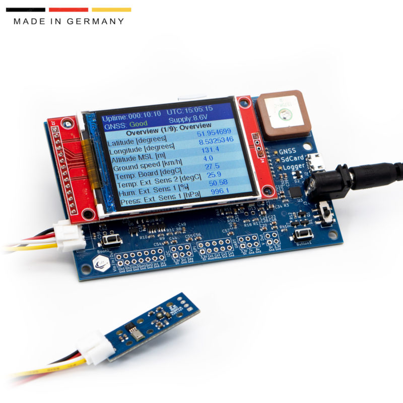
Description
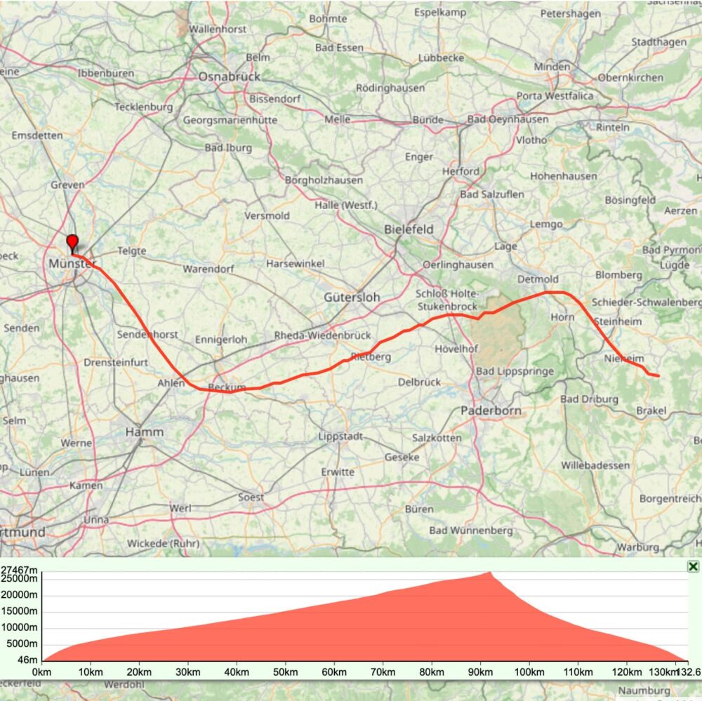
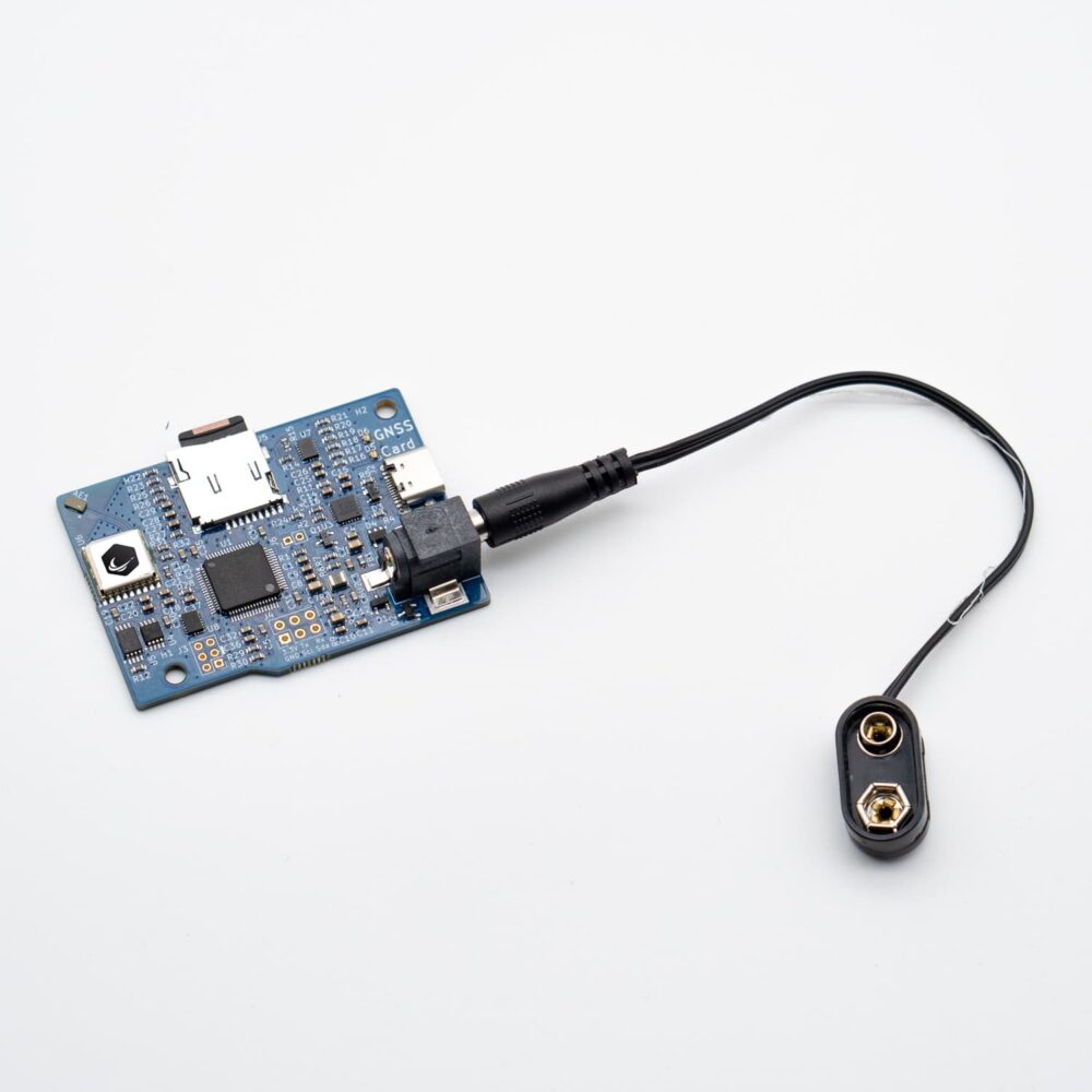
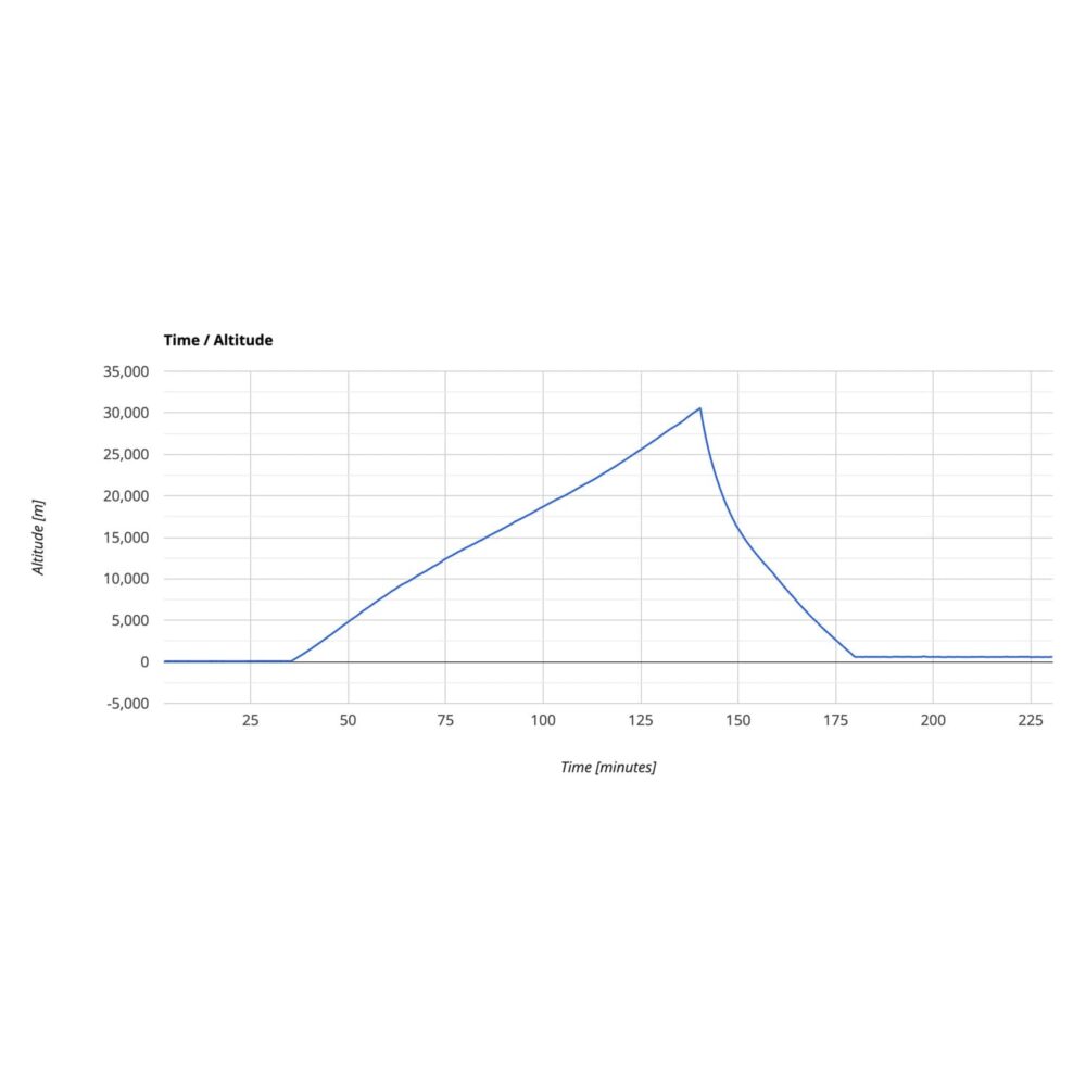
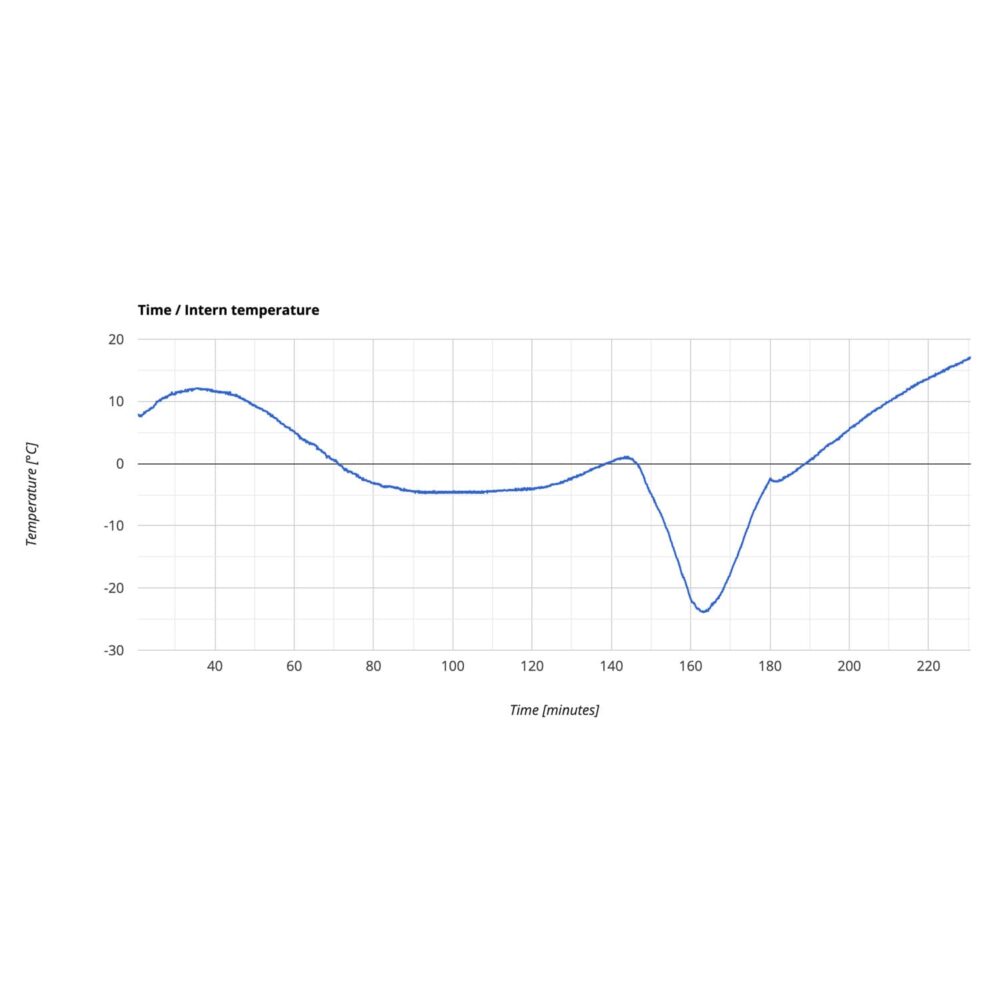
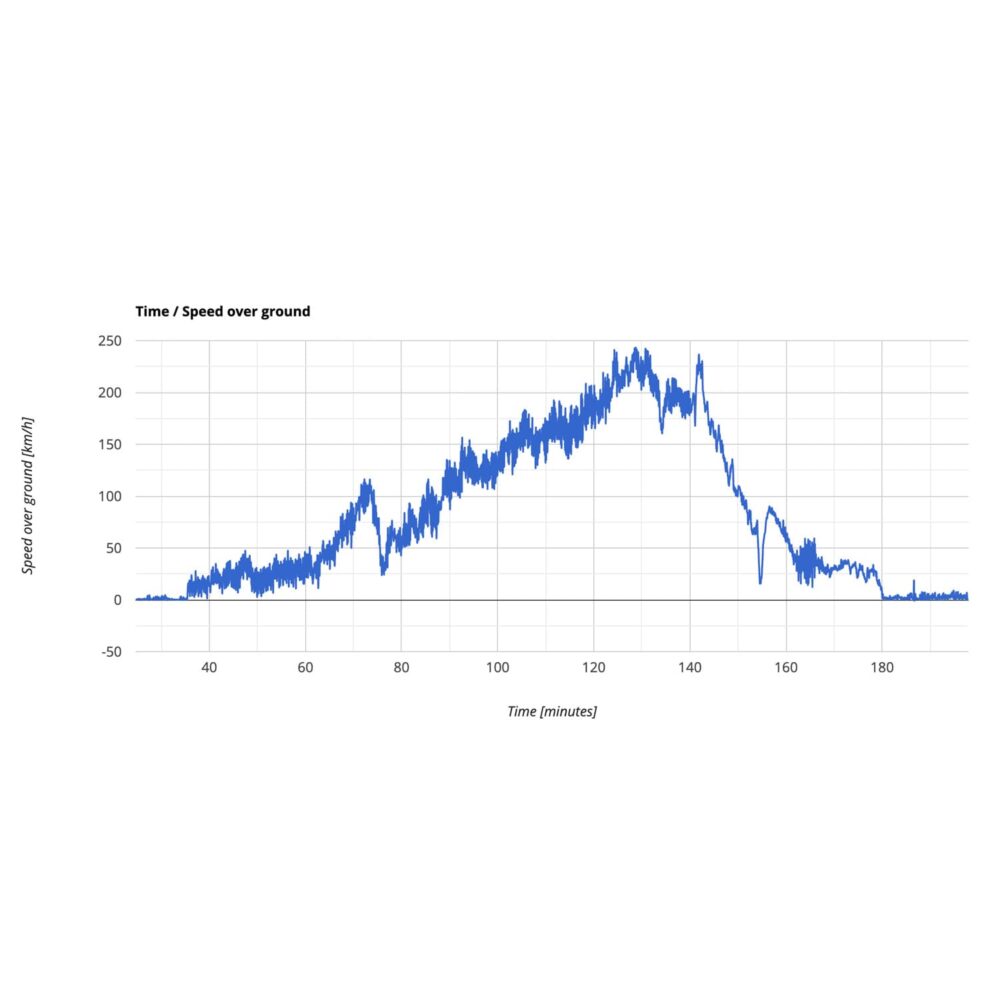
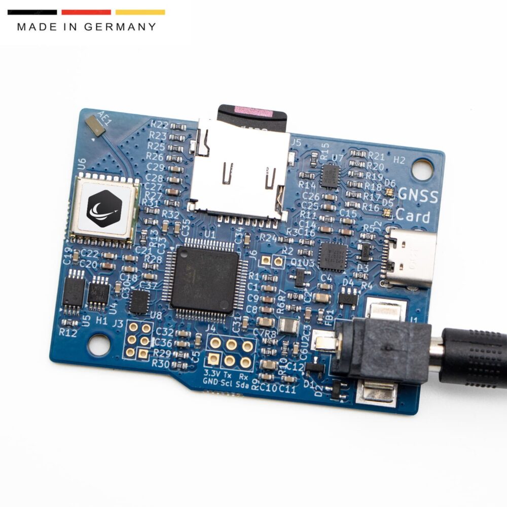
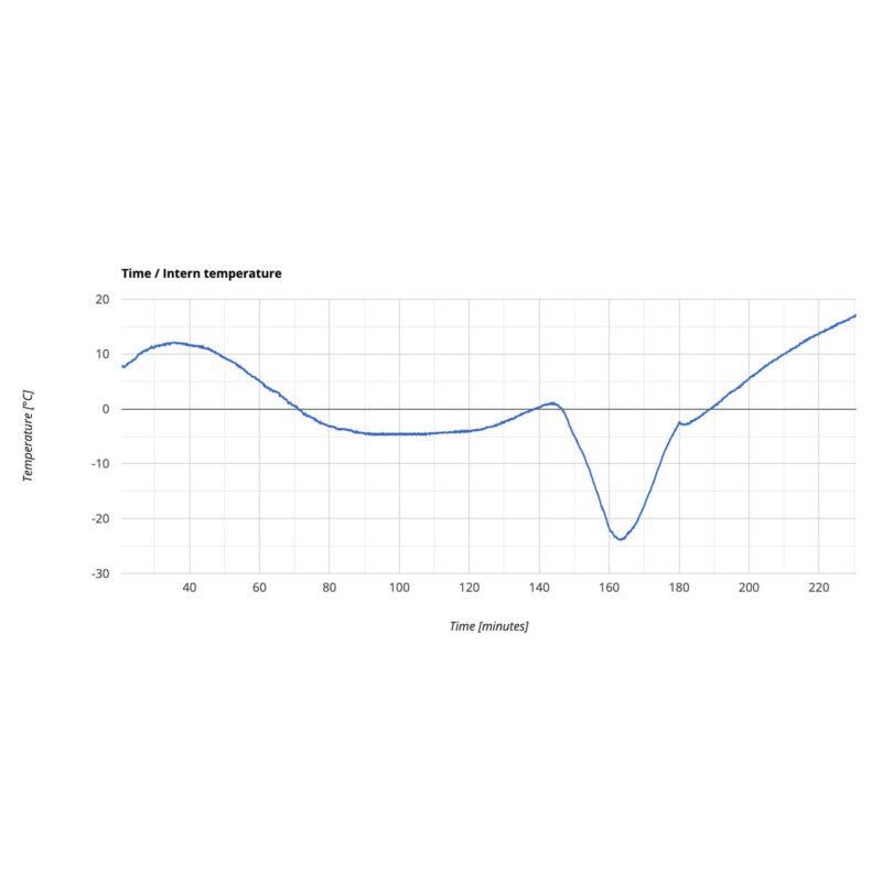
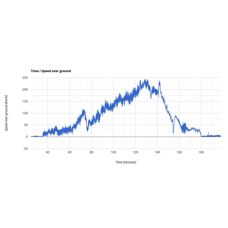
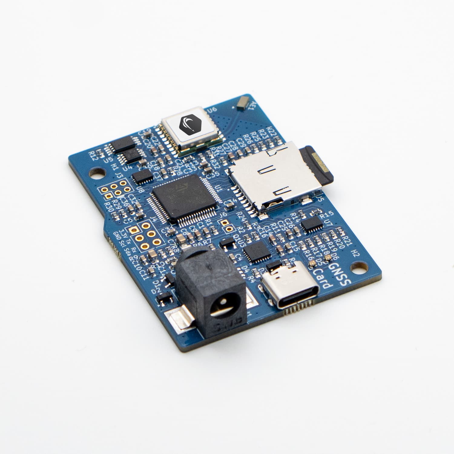
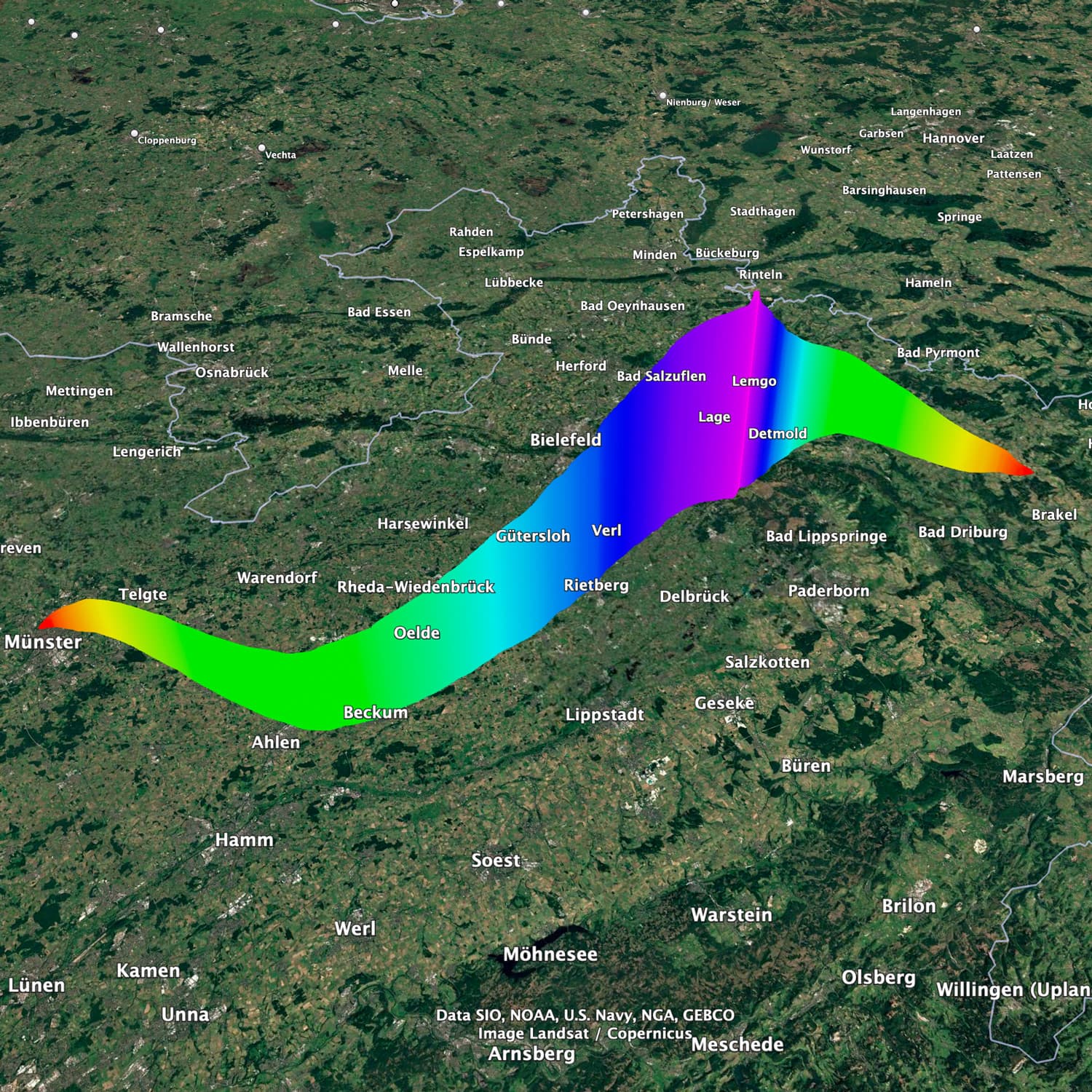
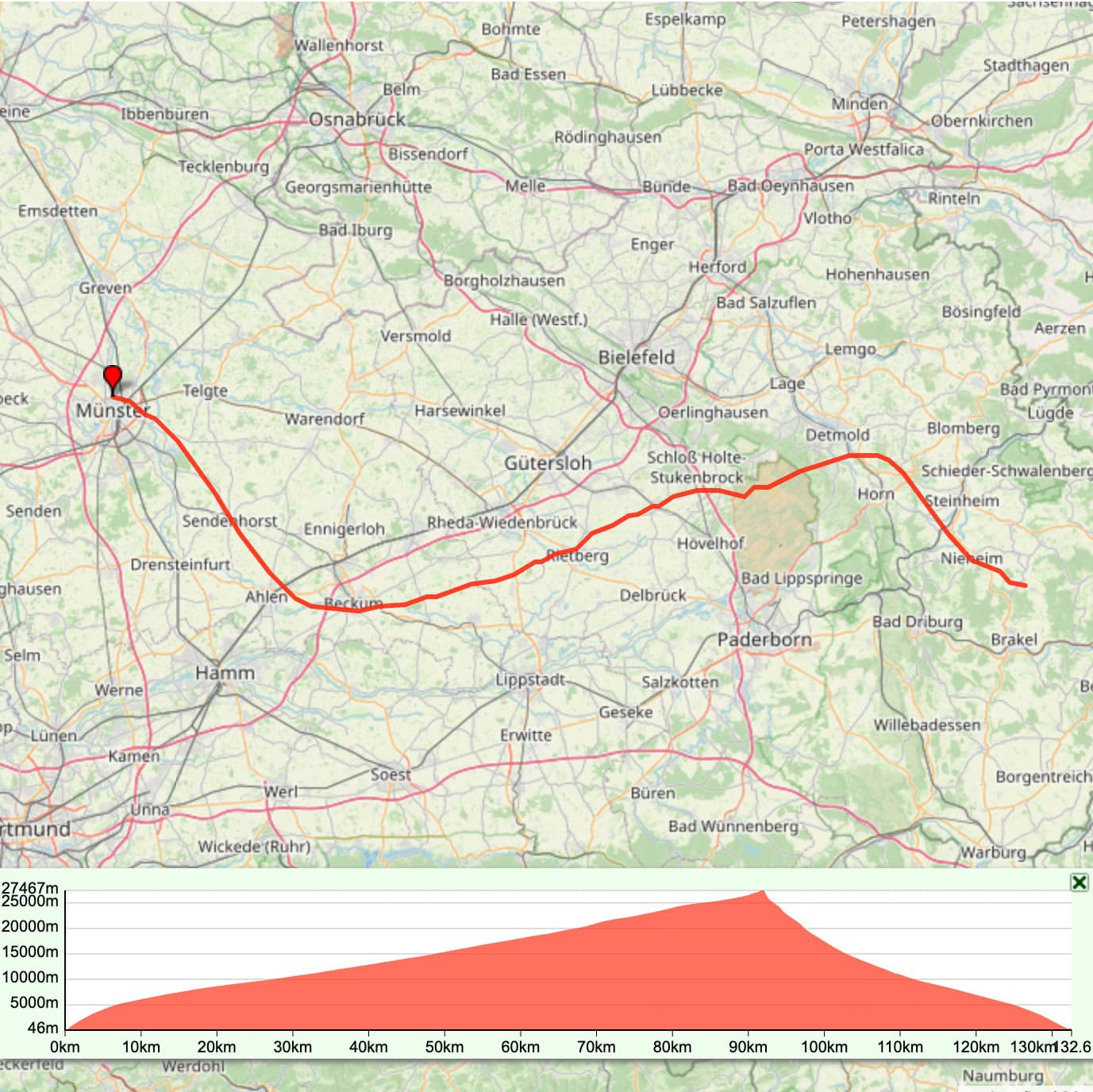
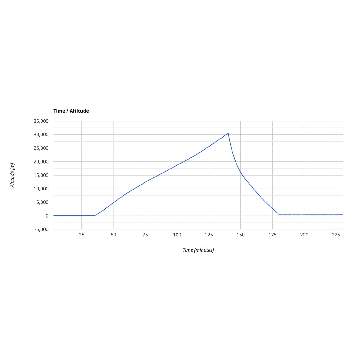
The datalogger STRATOmini was specially developed for recording the exact GPS position of your stratosphere probe. The STRATOmini records GPS data up to 50,000 meters (51mi) high! Thus not only the entire flight route will be recorded, it also reveals the mystery of the maximum altitude you reached. The GPS data is stored every two seconds on a microSD card and can be easily evaluated on the computer after the successful flight. Our online tool generates graphs of the flight path with just a few clicks. As a special highlight, the flight route can be displayed as a 3D curve in Google Earth. The STRATOmini is extremely light with its 13g (!) (0.4oz) and the design in the size of a matchbox makes the datalogger easy to attach inside a small probe. If you want to record further measurement data such as temperature, air pressure and humidity, our Datalogger STRATO4 is ideally suited for this purpose.
Features
- Unlocked GPS module: Records data up to an altitude of 50,000m (51mi). Most GPS modules are limited from a height of about 18,000m (11.2mi)!
- Records data on microSD flash card (.csv)
- Easy readout of the data from the microSD card
- Online tool: Datalogger evaluation to create graphs
- Online tool: Datalogger evaluation to create a 3D flight curve in Google Earth
- Easy to use, no programming knowledge required
- Extensive illustrated user manual
- Extremely lightweight design in matchbox format
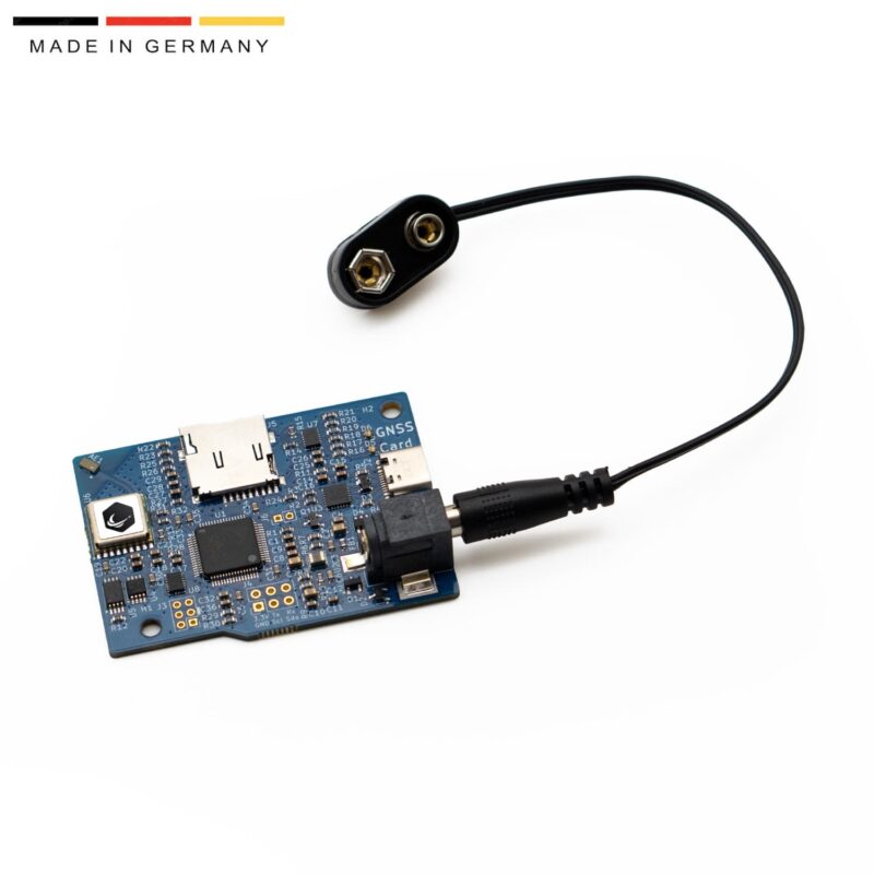
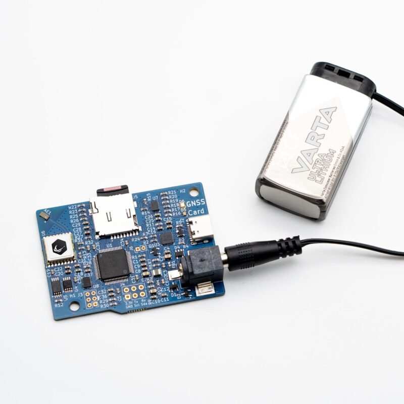
- Power Supply: 9V Battery for Datalogger
Useful links
- Download manual
- Data Sheet Datalogger STRATOmini (PDF)
- Online tool to create graphs from the measured data and a 3D flight track
- Online tool to create a 3D-Google-Earth flight track
- Sample file: 3D-Google-Earth-flight-path
- Sample log-file from STRATOmini
Video tutorial for data logger evaluation


DCK –
the strato mini provided solid gps data for my stratoflight. easy to use, no setup time, good documentation and easy data access.